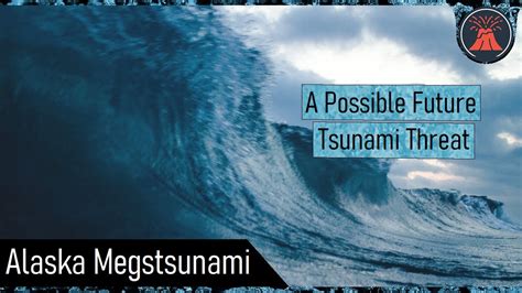
A potential mega-tsunami, triggered by a massive landslide in the Canary Islands, could unleash a 1,000-foot wave capable of devastating coastlines across the Atlantic, according to new research and simulations. The concern stems from the unstable Cumbre Vieja volcano on La Palma, where a future eruption could trigger a catastrophic flank collapse, sending a massive amount of rock and debris into the ocean.
Mega-Tsunami Threat Looms Over Atlantic Coastlines
Scientists are warning of the potential for a mega-tsunami generated by a landslide on the island of La Palma in the Canary Islands, which could send a towering wave of up to 1,000 feet towards coastlines across the Atlantic Ocean. The concern centers on the Cumbre Vieja volcano, whose unstable western flank poses a significant threat. A future eruption could trigger a massive landslide, displacing an enormous volume of water and creating a wave far larger than those typically associated with earthquakes.
The threat is not new; scientists have been studying the Cumbre Vieja volcano for years, recognizing its potential for catastrophic failure. Previous research and simulations have highlighted the possibility of a mega-tsunami, and the latest warnings serve as a reminder of the ongoing risk. “The Cumbre Vieja volcano on La Palma in the Canary Islands is still a restless giant,” explains Dr. Simon Day, a researcher who has studied the volcano’s stability for years. He and his colleagues have modeled the potential impact of a landslide-generated tsunami, revealing the devastating consequences for coastal communities.
The primary danger lies in the volcano’s structure. Cumbre Vieja is a stratovolcano, composed of layers of lava and volcanic ash. The western flank of the volcano is particularly unstable, due to its steep slope, the presence of weakened rock layers, and the potential for magma intrusion to further destabilize the area. An eruption could trigger a massive landslide, with estimates suggesting that anywhere from 500 cubic kilometers of rock could slide into the ocean.
The impact of such a landslide would be immediate and dramatic. The sudden displacement of water would generate a series of waves, with the initial wave reaching immense heights. As the wave propagates across the Atlantic, it would gradually decrease in height but still retain significant destructive power. Coastal areas in the Canary Islands, West Africa, Europe, and the Americas would all be at risk.
Simulations of a mega-tsunami generated by Cumbre Vieja show that the initial wave could reach heights of several hundred feet as it approaches the African coast, potentially causing widespread flooding and destruction. The wave would then continue across the Atlantic, impacting the coasts of Europe and the Americas. While the wave height would decrease with distance, even a wave of several meters could cause significant damage to coastal infrastructure and communities.
The specific impacts of a mega-tsunami would depend on a variety of factors, including the size and location of the landslide, the bathymetry of the ocean floor, and the shape of the coastline. However, even under the most optimistic scenarios, the consequences would be severe. Coastal cities would be inundated, infrastructure would be destroyed, and countless lives would be at risk.
Scientists emphasize that a mega-tsunami is not inevitable. The Cumbre Vieja volcano may never experience a flank collapse large enough to generate such a wave. However, the potential for such an event exists, and it is essential to understand the risks and prepare accordingly. Monitoring the volcano’s activity is crucial, as is developing early warning systems and evacuation plans for coastal communities.
The geological history of the Canary Islands provides evidence of past landslides and tsunamis. While no mega-tsunamis have occurred in recorded history, geological deposits suggest that large landslides have occurred in the past, generating significant waves. This evidence underscores the potential for future events and highlights the importance of ongoing research and monitoring.
The potential for a mega-tsunami highlights the complex and interconnected nature of geological hazards. Volcanic activity, landslides, and tsunamis are all linked, and a single event can trigger a cascade of devastating consequences. Understanding these connections is crucial for mitigating the risks and protecting coastal communities.
While the threat of a mega-tsunami is real, it is important to maintain perspective. The probability of such an event occurring in the near future is relatively low. However, the potential consequences are so severe that it is essential to take the threat seriously and prepare accordingly. Ongoing research, monitoring, and preparedness efforts are crucial for mitigating the risks and protecting coastal communities.
The complexity of the issue also includes socio-economic impacts on the surrounding areas. The Canary Islands rely heavily on tourism, and the publicity of these potential events could harm that economic sector. Mitigating public alarm while maintaining transparency about potential risks is critical.
The scientific community continues to refine models and improve monitoring techniques to better understand the behavior of Cumbre Vieja and the potential for future landslides. This includes deploying advanced sensor networks to detect ground deformation, monitoring volcanic gas emissions, and analyzing seismic activity. The goal is to provide early warning of any potential instability and to give coastal communities ample time to prepare.
International collaboration is also essential. Scientists from around the world are working together to share data, develop models, and coordinate preparedness efforts. This collaborative approach is crucial for addressing the global threat posed by mega-tsunamis.
The threat of a mega-tsunami serves as a reminder of the power of nature and the importance of understanding and mitigating geological hazards. While the probability of such an event occurring in the near future is low, the potential consequences are so severe that it is essential to take the threat seriously and prepare accordingly. Ongoing research, monitoring, and preparedness efforts are crucial for protecting coastal communities and minimizing the impact of future events.
“The potential for a large landslide and subsequent tsunami is real, and we need to continue to study the volcano and develop strategies to mitigate the risks,” says Dr. Maria Santos, a volcanologist specializing in the Cumbre Vieja volcano. “Early warning systems and evacuation plans are essential for protecting coastal communities.”
The need for more funding towards geological studies and monitoring is also critical, especially when it comes to providing accurate and reliable data to the public. Public awareness and education are paramount to ensure that communities are informed and can act accordingly when disaster strikes. This education includes understanding warning signs, evacuation routes, and emergency preparedness measures.
Ultimately, the threat of a mega-tsunami highlights the need for a comprehensive and coordinated approach to disaster risk reduction. This includes investing in research and monitoring, developing early warning systems, preparing evacuation plans, and educating the public. By working together, we can mitigate the risks and protect coastal communities from the devastating consequences of a mega-tsunami.
The discussion surrounding the Cumbre Vieja volcano is not just about the scientific aspects, but also the ethical responsibilities of scientists and policymakers. How should risk information be communicated to the public without causing undue panic? What is the appropriate balance between caution and economic considerations? These are complex questions that require careful consideration and collaboration between scientists, policymakers, and the public.
In conclusion, the possibility of a mega-tsunami originating from the Cumbre Vieja volcano in the Canary Islands remains a significant concern. While the probability of such an event occurring in the near future is relatively low, the potential consequences are devastating. Continued research, monitoring, and preparedness efforts are crucial for mitigating the risks and protecting coastal communities. A comprehensive and coordinated approach to disaster risk reduction is essential, involving scientists, policymakers, and the public working together to address this complex challenge.
Frequently Asked Questions (FAQ)
-
What is a mega-tsunami, and how is it different from a regular tsunami?
A mega-tsunami is a tsunami with an initial wave height significantly larger than that of a typical tsunami. While regular tsunamis are often caused by underwater earthquakes and have wave heights that can range from a few feet to tens of feet, mega-tsunamis are typically caused by massive landslides or volcanic eruptions and can generate initial wave heights of hundreds or even thousands of feet. This immense size makes them far more destructive and capable of causing widespread devastation across entire oceans. “A mega-tsunami is characterized by its scale,” says Dr. Day. “The energy and volume of water displaced are orders of magnitude greater than a typical tsunami.”
-
How likely is a mega-tsunami to occur from the Cumbre Vieja volcano in La Palma?
While scientists agree that the Cumbre Vieja volcano has the potential to generate a mega-tsunami, the probability of such an event occurring in the near future is considered relatively low. The timing and magnitude of a future eruption, as well as the extent of any subsequent landslide, are uncertain. “It’s important to distinguish between possibility and probability,” explains Dr. Santos. “While the potential exists, we cannot say with certainty when or if a mega-tsunami will occur.” Ongoing monitoring and research are aimed at better assessing the risk and providing early warning if conditions change.
-
Which coastal areas are most at risk from a mega-tsunami originating from La Palma?
Simulations suggest that coastal areas across the Atlantic Ocean could be affected by a mega-tsunami originating from La Palma. The Canary Islands themselves, as well as the coasts of West Africa, Portugal, Spain, and the British Isles, would be among the first to be impacted. The eastern coast of North America, including the Caribbean islands and the eastern seaboard of the United States, would also be at risk, although the wave height would likely be reduced by the time it reaches these areas. The degree of impact would depend on various factors, including the size of the landslide and the bathymetry of the ocean floor.
-
What kind of warning systems are in place to detect and alert people to a mega-tsunami threat?
Currently, there are no specific warning systems designed exclusively for mega-tsunamis. Existing tsunami warning systems primarily focus on detecting tsunamis generated by earthquakes. These systems rely on seismic sensors and deep-ocean buoys to detect changes in water pressure. However, research is underway to develop more comprehensive warning systems that can also detect landslides and volcanic activity. Such systems would likely involve a combination of monitoring techniques, including seismic sensors, GPS devices to measure ground deformation, and satellite imagery to detect changes in the volcano’s structure. “Improving early warning systems is crucial,” says Dr. Santos. “We need to be able to detect potential landslides in real-time and provide timely warnings to coastal communities.”
-
What can people do to prepare for a potential mega-tsunami?
Preparing for a mega-tsunami is similar to preparing for any other type of tsunami or natural disaster. The most important steps include:
- Knowing the Risks: Understand the potential risks in your area and whether you live in a tsunami hazard zone.
- Developing an Emergency Plan: Create a family emergency plan that includes evacuation routes, meeting points, and communication strategies.
- Assembling a Disaster Kit: Prepare a disaster kit with essential supplies, such as food, water, medications, and a first-aid kit.
- Staying Informed: Monitor official sources of information, such as the National Weather Service and local emergency management agencies.
- Participating in Drills: Participate in community tsunami drills to practice evacuation procedures.
- Following Evacuation Orders: If an evacuation order is issued, evacuate immediately to higher ground.
It’s also important to be aware of local emergency plans and to cooperate with authorities during an emergency. Educating yourself and your community about the risks and how to prepare can significantly increase your chances of survival.
In-Depth Analysis and Expanded Context:
The threat posed by the Cumbre Vieja volcano goes beyond a single, isolated event. It highlights the cascading nature of geological hazards and the interconnectedness of Earth’s systems. The volcano’s instability is influenced by a complex interplay of factors, including tectonic activity, magma intrusion, and the volcano’s own internal structure.
The underlying tectonic setting of the Canary Islands plays a crucial role. The islands are located on the African plate, near its boundary with the Eurasian plate. The movement of these plates creates stress and strain in the Earth’s crust, which can contribute to volcanic activity and earthquakes. The Cumbre Vieja volcano is located on the island of La Palma, which is one of the youngest and most volcanically active islands in the archipelago.
The volcano’s structure is also a key factor. Cumbre Vieja is a stratovolcano, which means that it is composed of layers of lava and volcanic ash. These layers can be relatively weak and prone to failure, especially when saturated with water. The western flank of the volcano is particularly unstable because it is steep and has been weakened by past eruptions and landslides. The presence of fault lines and fractures also contributes to the instability.
Magma intrusion is another important factor. As magma rises from the Earth’s mantle, it can intrude into the volcano’s structure, further weakening the rock and increasing the risk of a landslide. The heat from the magma can also cause the rock to expand and contract, creating stress and strain.
The geological history of the Canary Islands provides evidence of past landslides and tsunamis. Geological deposits on the islands indicate that large landslides have occurred in the past, generating significant waves. For example, the El Golfo landslide on the island of El Hierro is estimated to have generated a tsunami that reached heights of hundreds of feet. While these events occurred thousands of years ago, they serve as a reminder of the potential for future events.
The simulations of a mega-tsunami generated by Cumbre Vieja are based on sophisticated computer models that take into account various factors, including the size and location of the landslide, the bathymetry of the ocean floor, and the shape of the coastline. These models provide valuable insights into the potential impacts of a mega-tsunami and can help to inform preparedness efforts.
However, it is important to recognize that these models are simplifications of reality and have limitations. The actual impacts of a mega-tsunami could differ from the model predictions. For example, the models may not fully capture the complex interactions between the wave and the coastline. They also typically assume a single, instantaneous landslide, whereas a real-world landslide might occur in stages or over a longer period of time.
Despite these limitations, the models provide a valuable tool for understanding the potential risks and for developing mitigation strategies. They can help to identify the most vulnerable areas and to prioritize preparedness efforts.
The economic and social impacts of a mega-tsunami would be enormous. Coastal cities would be inundated, infrastructure would be destroyed, and countless lives would be at risk. The economic costs of rebuilding and recovery would be staggering. The social impacts would include displacement, loss of livelihoods, and psychological trauma.
The tourism industry, which is a major source of revenue for many coastal communities, would be severely affected. The destruction of hotels, resorts, and other tourist attractions would lead to a sharp decline in tourism. The long-term impacts on the tourism industry could be devastating.
In addition to the direct impacts of the tsunami, there would also be indirect impacts on other sectors of the economy. For example, the disruption of transportation networks could affect supply chains and trade. The loss of agricultural land could lead to food shortages. The destruction of power plants and communication networks could disrupt essential services.
The potential for a mega-tsunami highlights the importance of investing in disaster risk reduction. This includes not only monitoring and research but also preparedness and mitigation measures. Early warning systems, evacuation plans, and building codes are all essential for reducing the risks and protecting coastal communities.
Public awareness and education are also crucial. People need to be aware of the risks and how to prepare for a tsunami. This includes knowing the evacuation routes, understanding the warning signs, and having a disaster kit.
Ultimately, mitigating the risks of a mega-tsunami requires a comprehensive and coordinated approach involving scientists, policymakers, and the public. By working together, we can reduce the vulnerability of coastal communities and protect them from the devastating consequences of these events.
The ethical dimensions of communicating the risk of a mega-tsunami are also significant. Scientists and policymakers face the challenge of providing accurate and reliable information without causing undue panic. Overstating the risk could lead to unnecessary fear and anxiety, while understating the risk could leave people unprepared.
The key is to communicate the risks in a clear and transparent manner, providing the best available scientific information while acknowledging the uncertainties. It is also important to emphasize the steps that people can take to prepare for a potential tsunami.
The decision of whether or not to evacuate coastal areas is a complex one, involving a trade-off between the costs and benefits of evacuation. Evacuations can be disruptive and expensive, and they can also cause anxiety and stress. However, they can also save lives.
The decision to evacuate should be based on the best available scientific information, as well as the local context and the specific circumstances of the event. It is also important to communicate the reasons for the evacuation decision to the public in a clear and transparent manner.
The long-term sustainability of coastal communities is also a concern. As sea levels rise and extreme weather events become more frequent, coastal communities will face increasing challenges. It is important to develop strategies for adapting to these changes and for ensuring the long-term viability of coastal communities.
This may involve relocating infrastructure and populations away from vulnerable areas, implementing coastal protection measures, and adopting sustainable development practices. It also requires a commitment to international cooperation and collaboration, as climate change and disaster risk reduction are global challenges that require global solutions.
The Cumbre Vieja volcano serves as a case study for understanding the complex interactions between geological hazards, societal vulnerabilities, and the need for effective risk management. By learning from this example, we can better prepare for and mitigate the risks of other natural disasters around the world.